


Railway over canal, or canal over railway?
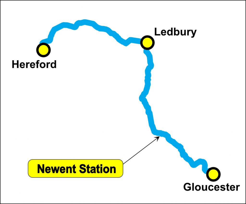
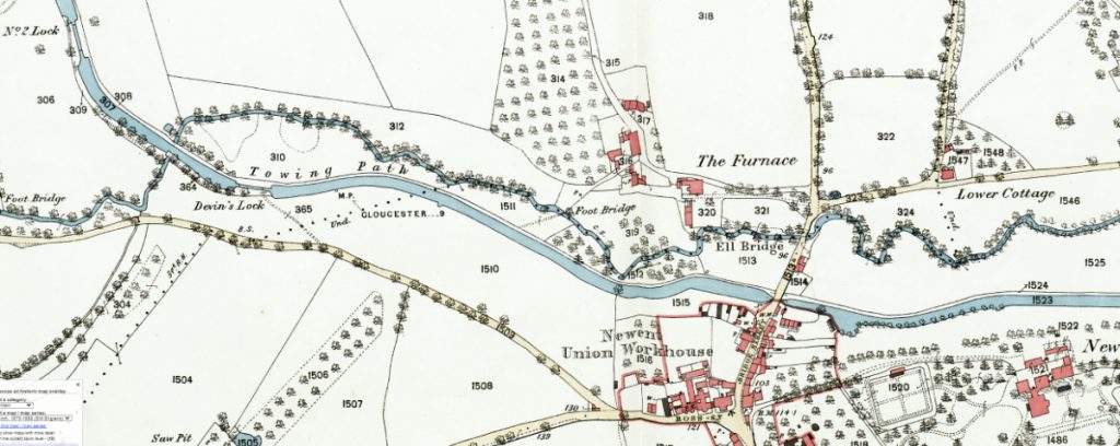
The Hereford and Gloucester Canal extended northwesterly from Gloucester towards Newent on its ultimate path to Hereford. Approaching the town, the canal rose through a series of locks, running parallel and just south of Ell Brook and an associated mill race. It crossed Bridge Street at Ell Bridge, rose again through Devin’s Lock before crossing Ell Brook Aqueduct and continuing north towards Oxenhall.
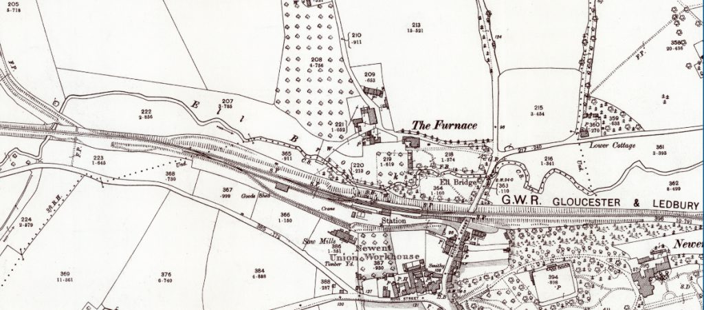
When the Gloucester – Ledbury railway was built it largely followed the course of the canal as far as Ell Brook Aqueduct, and the canal channel was, for the most part, filled in or swept away so the new rail track could be laid on solid ground.
For many years the H & G Canal Trust has nurtured a strategy for the restoration of Newent Station along with the extension of the canal from both eastern and western directions. These plans include a significant new stretch of water from Oxenhall up to the old station platforms, a distance of nearly a third of a mile (nearly half a kilometre).
Restoring this stretch of canal isn’t just about preserving heritage – it’s about unlocking real, lasting benefits for the Newent community.
This is an ambitious and inspiring undertaking, and we can’t do it alone … whether you can offer financial support, professional expertise in planning, engineering, or construction, or simply time and enthusiasm to help on the ground – we need you.
Together, we can bring this vital piece of Newent’s history back to life.
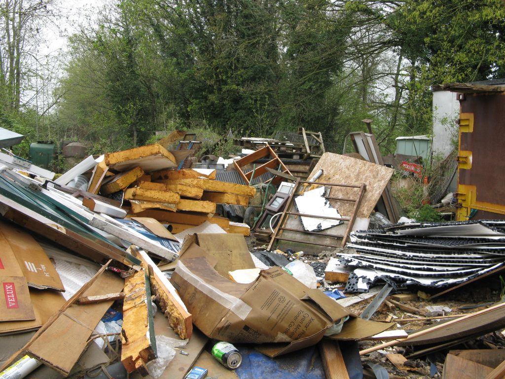
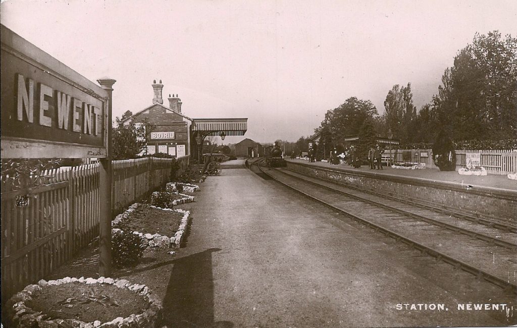
The first work to restore the canal in the Newent area commenced around 2005 on the site of the former railway station, which here was itself on the line of the original canal as far as the Ell Brook crossing, where the railway left the line of the canal on its way to Ledbury. Much of the old station yard had been occupied for many years by a builder’s merchant and was largely overgrown with few of the actual features visible.
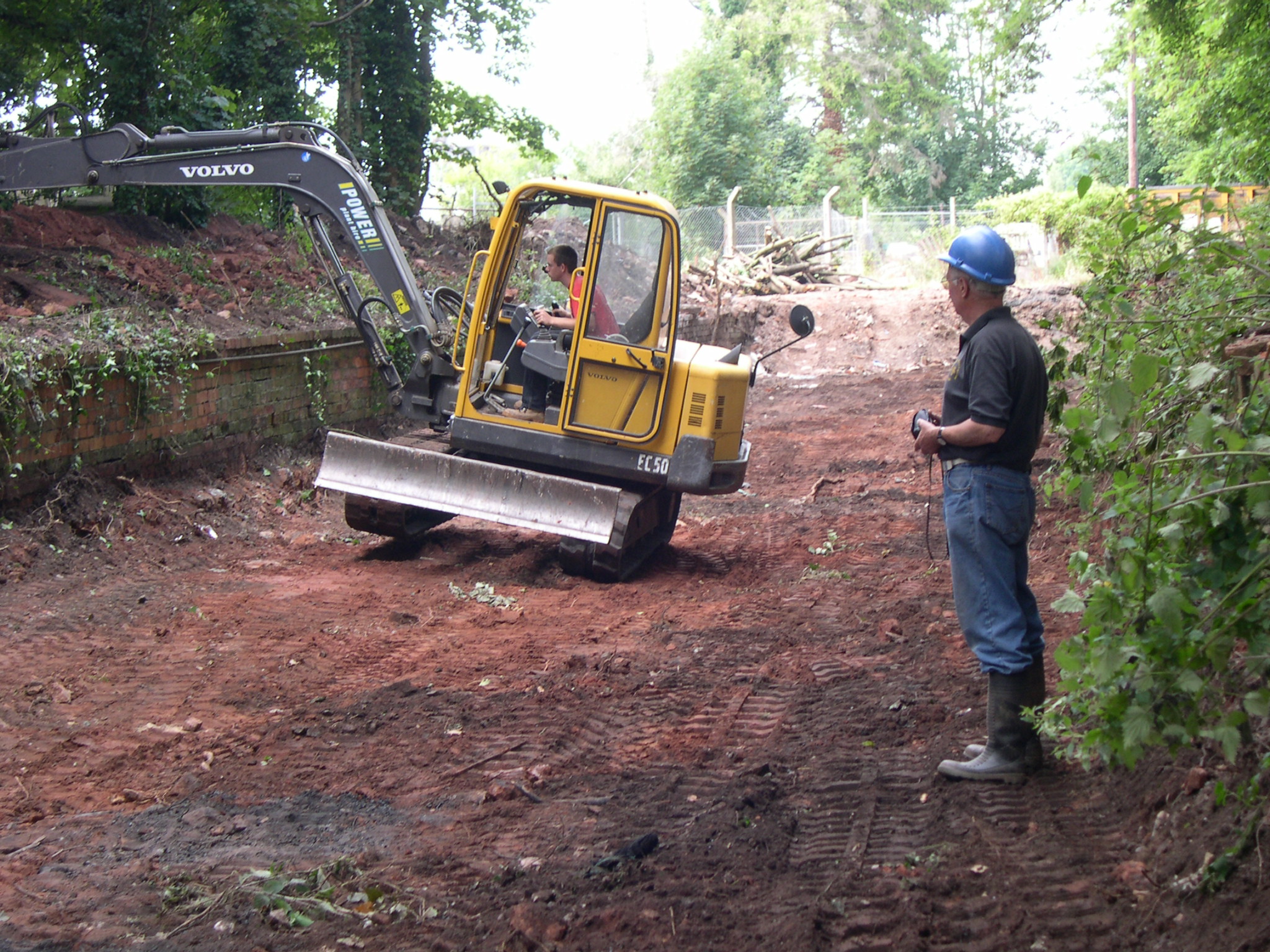
A dedicated team of volunteers was quickly mobilised, and work started initially with clearing of the vegetation. This revealed a good many accumulations of building materials which were recovered to the best extent possible and then sold to raise funds or set aside for re-use by the Trust.

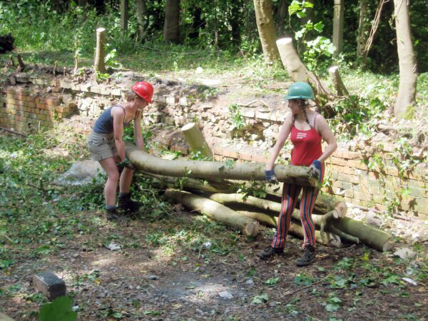
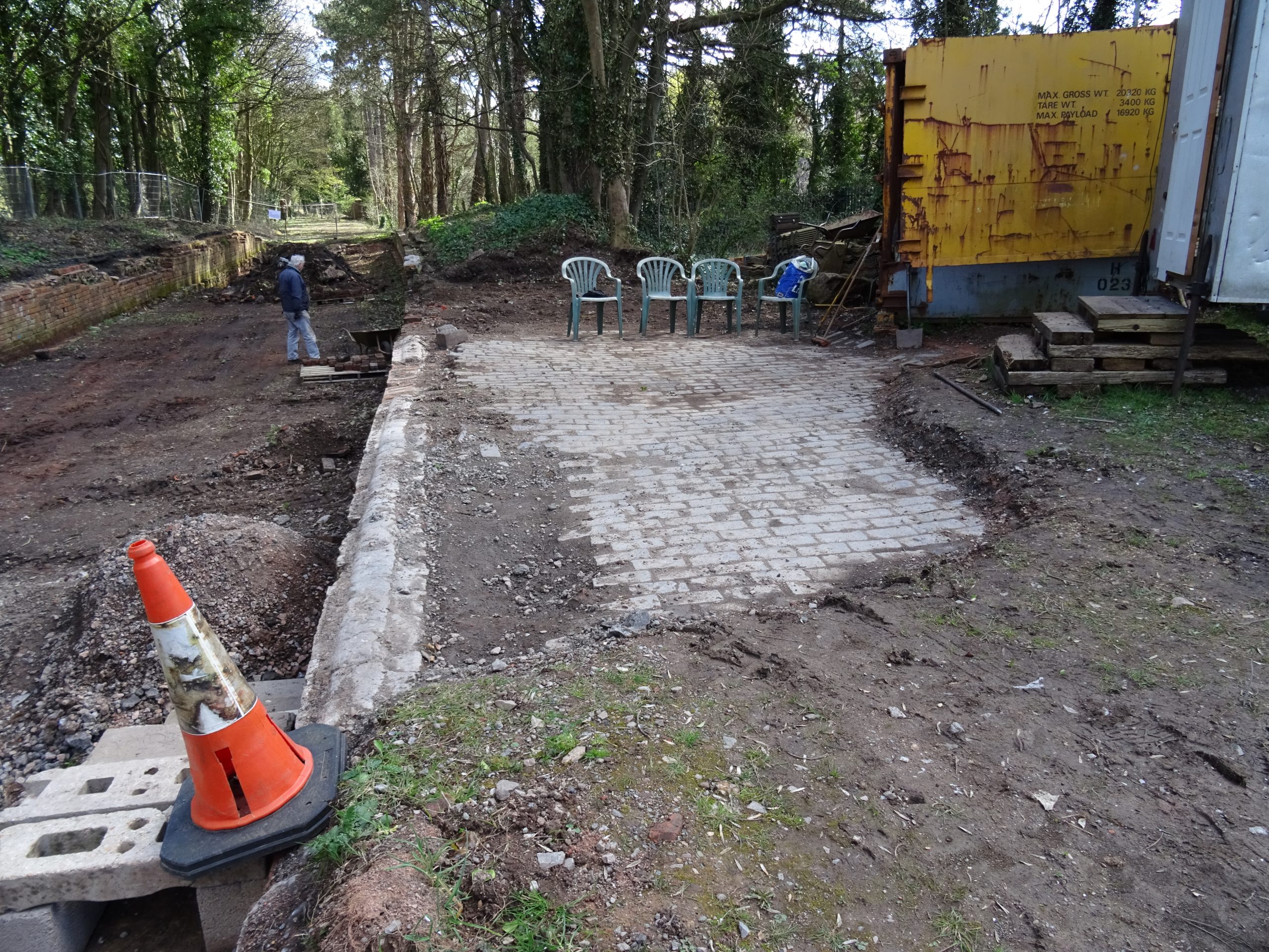
With much of the site now more visible, 19th century plans of the station were consulted, and the positions of the station buildings and its platforms were roughly marked out. and further work to remove remaining accumulations of debris slowly succeded in revealing the surfaces of the original platforms, and then the foundation of the station buildings and signal box. Sadly, although some blue brick platform surfacing was found, the original massive stone copings forming the platform edges appeared to have been taken up and removed at some point in the past.

In 2015, the Trust managed to take control of the lease covering much of the former Newent Station yard, including the site of station buildings itself allowing plans for the restoration of the canal to be further developed.
Originally, as noted above, the canal ran directly through the site of the station, but at a level below that of the former rail tracks, having dropped progressively from the Oxenhall Tunnel level through the three Oxenhall locks and Devin’s lock close to the Ell Brook crossing.
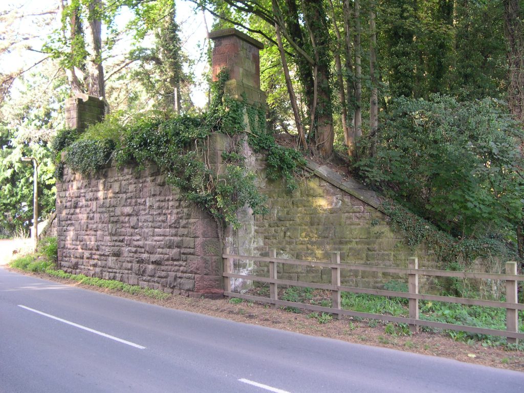
Bridge Street / Dymock Road would therefore have passed over the canal on a bridge. The railway engineers pursued a different course and raised the railway onto an embankment, and by lowering the road level were able to take the rails over the road on a stone and cast iron bridge, of which only the substantial stone abutments now remain.
Plan A – Water instead of Rails?
Initial plans for canal restoration similarly focussed on raising the level of the canal so it too could pass not only over Bridge Street but also between the former station platforms. This would have required considerable civil engineering work to raise the track bed by as much as 3m to allow the depth of the canal channel to clear the road whilst maintaining headroom for modern roadgoing vehicles.
Raising of the ground level would have extended westwards past the site of Devin’s Lock and onwards across the fully restored Ell Brook Aqueduct as far as Oxenhall No 2 lock, the depth of which would have been reduced by the changes in ground level.
To compensate for the changes in canal levels, two new locks would have been needed east of the Dymock Road bridge, just north of the current fire station, before a new canal cut alongside the Ell Brook would continue the canal restoration eastwards, the original canal line having been lost beneath Newent bypass.
As the scope of the work needed became clear, it was recognised that an alternative solution may be needed to recreate the canal through the former station site.
The Newent Project Team – and Plan B
In view of the above finding, the Newent Project Team re-considered various ways of taking the canal across Bridge Street, whilst reducing the “footprint” of the scheme and, in 2019 a new method was adopted as the way forward – an inclined plane.
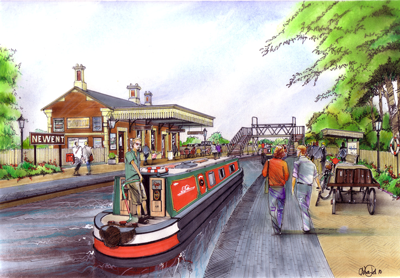
Boats traveling down from Oxenhall will be cradled out of the water onto a wheeled trolley, up an initial slope, along a level track through the station – between the platforms (thus fulfilling part of the original vision), up another small incline to reach the required height over Bridge Street and then down the other side to be set afloat again at a basin located behind the fire station. This will replace the need for two locks, whilst pitching the canal at a level suitable for crossing Cleeve Mill Lane, a feature which will increase the attraction of the site. Boats traveling up towards Hereford will of course make the journey in reverse.
Much of the current ground level (deriving from the railway period) can be maintained, with only a short section requiring to be raised up and over the Bridge Street crossing.
Newent station can therefore be restored at its historic level.
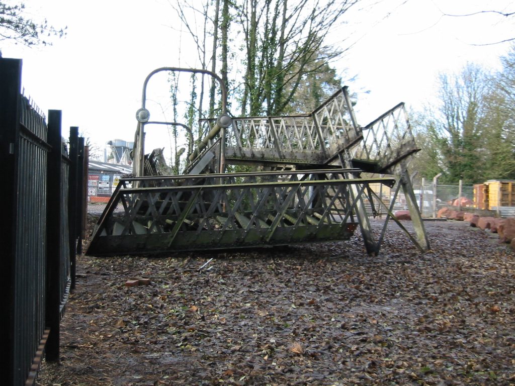
Plans include recreation of the station building in keeping with its original appearance as a café, tourist attraction and H&G Canal visitor centre of benefit to the local community and visitors, as well as provision of the inclined plane rail tracks between the old station platforms. The station building will be on the south side while the towpath will be on the north side, the two connected by an original GWR footbridge from the closed railway which the H&G CT already owns.
The team are looking at designs for the station buildings to be as close as possible to the style of the originals. They have some pictures of the old station but if anyone knows of any other pictures please get in touch – they will be very welcome.
Another major benefit to this scheme is that the original section of the canal below House Lock which was not swept away by railway construction can be restored at its historic level. This includes the reconstruction of No.2 Lock, the one below House Lock. The water level in the canal channel will be slightly raised to allow passage over the previously strengthened Ell Brook Aqueduct before reaching the station area. East of the Bridge Street crossing and the end of the proposed inclined plane, a new cut will be required, as the original line lies beneath the bypass constructed in the 1970’s. This will follow a path between the bypass and Ell Brook to a point just beyond Cleeve Mill Lane where it will re-join the original canal line.
As has been demonstrated at Over and elsewhere, a great deal of the work needed can be undertaken by volunteers.
Moving Forward …
November 2024 saw a significant move by the Trust in this direction with a request for advice from FoDDC (Forest of Dean District Council) about a future planning application. FoDDC have provided a positive, yet challenging, response with a list of pre-requisites to be addressed before a planning application can be made.
The Trust is now working to address the following:
- Arboricultural assessment
- Biodiversity net gain
- Arboricultural Method Statement
- Tree Protection Plan
- Archaeological assessment
- Heritage statement
- Lighting Impact assessment
- Land contamination statement
- Landscape assessment
- Waste minimisation statement
- Footpath Diversion Application
- Flood Risk
- Ecological Impact (to include bats, dormice, great crested newts, otter, water voles and reptiles)
- Construction plans / drawings detailing the five phases of development:
- Extension of the canal east from Oxenhall
- Reconstruction of the Newent Station buildings and surrounding landscape
- Canal and winding pool east of the Fire Station
- Bridge over the B4215 Dymock road
- Reconstruction of Lock No.2 at Oxenhall
The target for the submission of a planning application is 2026.
The scheme will be divided into a number of sections …
- Initially, work will cover the restoration of the canal from the site of Lock No 2 below Oxenhall House Lock through The Willows to the start of what we call the Station Section.
- The second stage will focus on the restoration of the station buildings, the platform and the surrounding area.
- Work will then continue on the east side of Bridge Street (Ledbury Road) alongside the fire station
- The sections to each side of Bridge Street will then be connected with a new bridge.
- Finally, this complete section will be re-connected to the canal remaining in water at Oxenhall by the recreation of the missing Oxenhall Lock No. 2.
This is an important project and we need volunteers at all levels to help make it happen.

More on the story at Newent…

All Change at Newent
Restoration of the canal at Newent has been heavily compromised by the construction of the Ledbury to Gloucester Railway over much of the canal below Oxenhall. The railway chose a high-level crossing at Bridge Street which involved lowering the road […]